


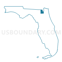
2A-Voting District, Baker County, Florida
About
Outline

Summary
| Unique Area Identifier | 550862 |
| Name | 2A-Voting District |
| County | Baker County |
| State | Florida |
| Area (square miles) | 52.97 |
| Land Area (square miles) | 52.95 |
| Water Area (square miles) | 0.01 |
| % of Land Area | 99.97 |
| % of Water Area | 0.03 |
| Latitude of the Internal Point | 30.20946390 |
| Longtitude of the Internal Point | -82.10008480 |
Maps


Graphs
Select a template below for downloading or customizing gragh for 2A-Voting District, Baker County, Florida


Neighbors
Neighoring Voting District (by Name) Neighboring Voting District on the Map
- 1-Voting District, Bradford County, FL
- 100-Voting District, Clay County, FL
- 11P-Voting District, Duval County, FL
- 2-Voting District, Union County, FL
- 3A-Voting District, Baker County, FL
- 405-Voting District, Nassau County, FL
- 5A-Voting District, Baker County, FL
Top 10 Neighboring County Subdivision (by Population) Neighboring County Subdivision on the Map
- Middleburg-Clay Hill CCD, Clay County, FL (54,763)
- Callahan-Hilliard CCD, Nassau County, FL (26,279)
- Macclenny CCD, Baker County, FL (14,215)
- Sanderson CCD, Baker County, FL (12,900)
- Baldwin CCD, Duval County, FL (6,971)
- Lawtey CCD, Bradford County, FL (6,327)
- Raiford CCD, Union County, FL (3,721)
Top 10 Neighboring Place (by Population) Neighboring Place on the Map
Top 10 Neighboring Unified School District (by Population) Neighboring Unified School District on the Map
- Duval County School District, FL (864,263)
- Clay County School District, FL (190,865)
- Nassau County School District, FL (73,314)
- Bradford County School District, FL (28,520)
- Baker County School District, FL (27,115)
- Union County School District, FL (15,535)
Top 10 Neighboring State Legislative District Lower Chamber (by Population) Neighboring State Legislative District Lower Chamber on the Map
Top 10 Neighboring State Legislative District Upper Chamber (by Population) Neighboring State Legislative District Upper Chamber on the Map
- State Senate District 5, FL (515,369)
- State Senate District 3, FL (495,081)
- State Senate District 14, FL (457,489)
Top 10 Neighboring 111th Congressional District (by Population) Neighboring 111th Congressional District on the Map
Top 10 Neighboring Census Tract (by Population) Neighboring Census Tract on the Map
- Census Tract 401.02, Baker County, FL (7,531)
- Census Tract 173, Duval County, FL (6,971)
- Census Tract 401.01, Baker County, FL (6,684)
- Census Tract 4, Bradford County, FL (6,327)
- Census Tract 402.02, Baker County, FL (5,381)
- Census Tract 505.04, Nassau County, FL (4,059)
- Census Tract 301.04, Clay County, FL (3,968)
- Census Tract 9601, Union County, FL (3,721)